关于这张照片
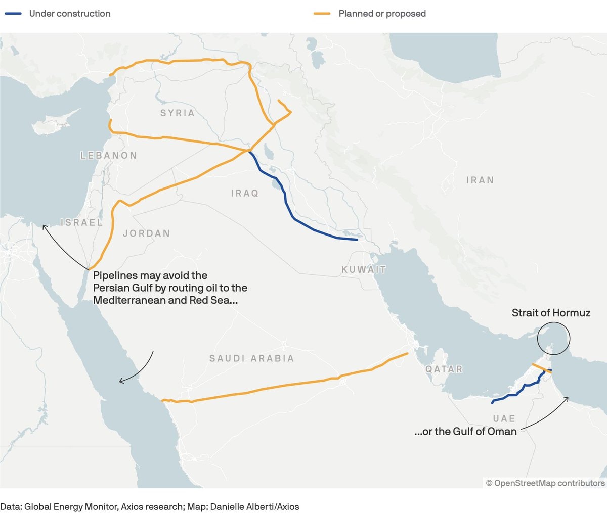
The image is a map showing proposed and under-construction oil pipelines in the Middle East. Orange lines indicate planned or proposed pipelines, while blue lines show those under construction. The map highlights routes that avoid the Persian Gulf, connecting to the Mediterranean and Red Seas, or the Gulf of Oman. The Strait of Hormuz is also labeled. The style is informational and data-driven, with a clean, cartographic aesthetic. ON-SCREEN TEXT: Under construction Planned or proposed Pipelines may avoid the Persian Gulf by routing oil to the Mediterranean and Red Sea... ...or the Gulf of Oman Strait of Hormuz Data: Global Energy Monitor, Axios research; Map: Danielle Alberti/Axios © OpenStreetMap contributors