关于这张照片
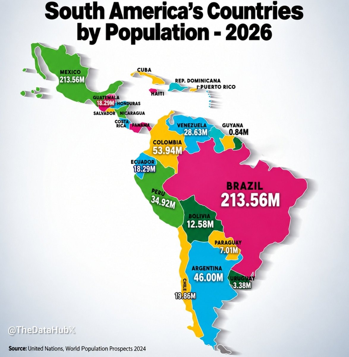
The image is a map of South America and surrounding regions, color-coded by country and displaying population figures for 2026. The focus is on the countries and their projected populations. The style is informational and infographic-like, with bold text and bright colors. A notable detail is the inclusion of Mexico and some Caribbean islands, which are not geographically part of South America. The on-screen text reads "South America's Countries by Population - 2026", "@TheDataHubX", and "Source: United Nations, World Population Prospects 2024".











还没有评论。来抢沙发吧!