
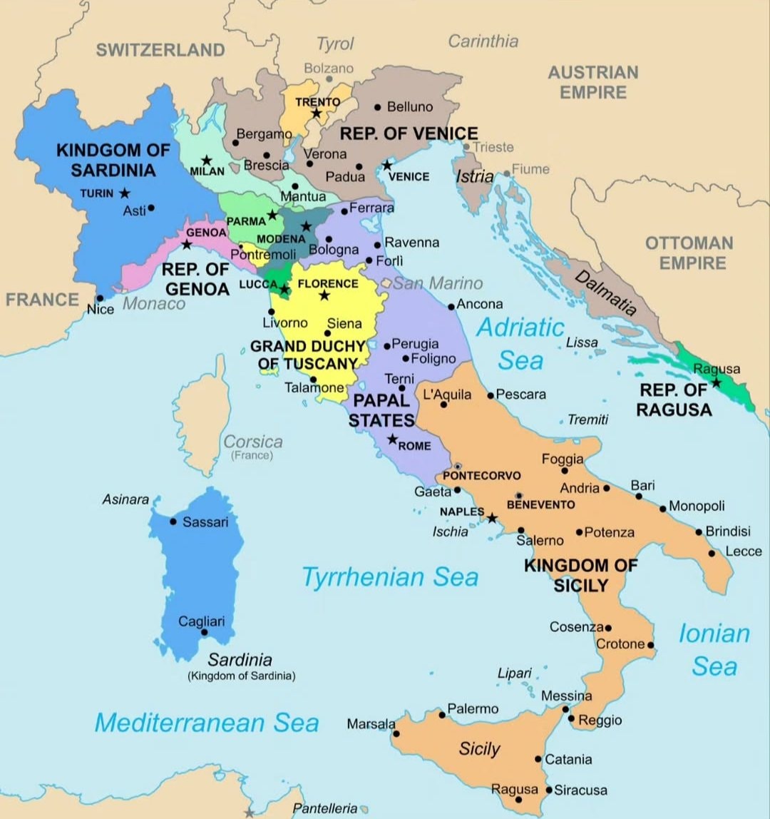
@scarlett_sItaly in 1796 🗺️ #InfoEditorials
查看原帖@scarlett_sItaly in 1796 🗺️ #InfoEditorials
查看原帖@scarlett_s 的照片· Sep 14, 2026· Info/Editorials
The image is a historical map of Italy. It shows various regions and kingdoms with their borders and names. The map is colorful and detailed, with a clear layout of geographical features and political divisions. The style is educational and informative, presenting a snapshot of Italy's political landscape at a specific historical period. Notable elements include the distinct colors used for each territory and the clear labeling of cities and bodies of water. ON-SCREEN TEXT: KINDGOM OF SARDINIA, FRANCE, SWITZERLAND, TYROL, CARINTHIA, AUSTRIAN EMPIRE, OTTOMAN EMPIRE, REP. OF VENICE, REP. OF GENOA, GRAND DUCHY OF TUSCANY, PAPAL STATES, KINGDOM OF SICILY, REP. OF RAGUSA, Corsica (France), Sardinia (Kingdom of Sardinia), Mediterranean Sea, Tyrrhenian Sea, Adriatic Sea, Ionian Sea.
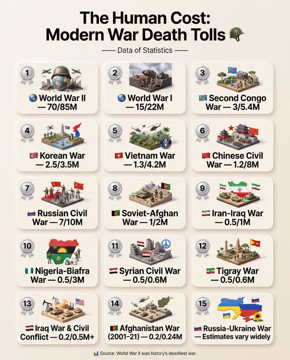 Modern War Death Tolls
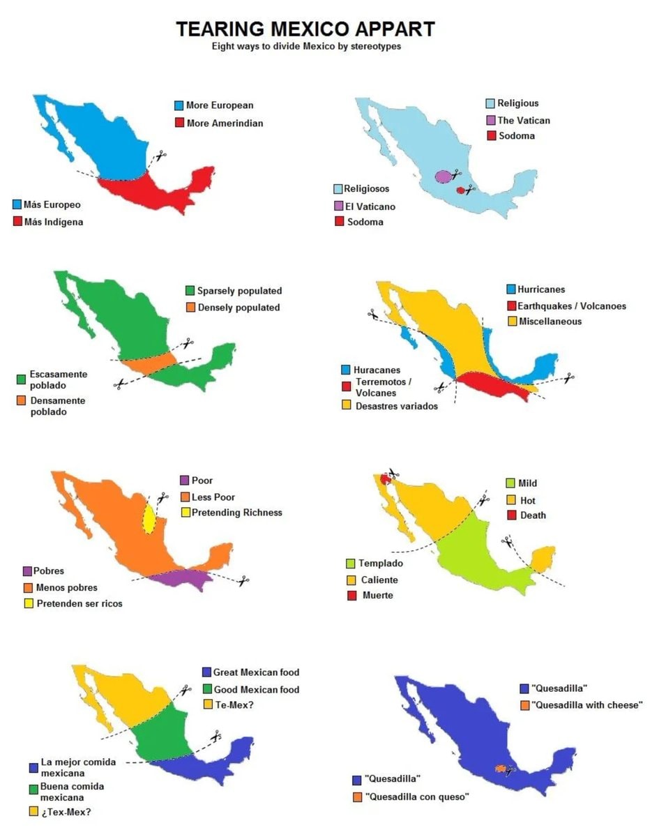 8 ways to divide Mexico by stereotype
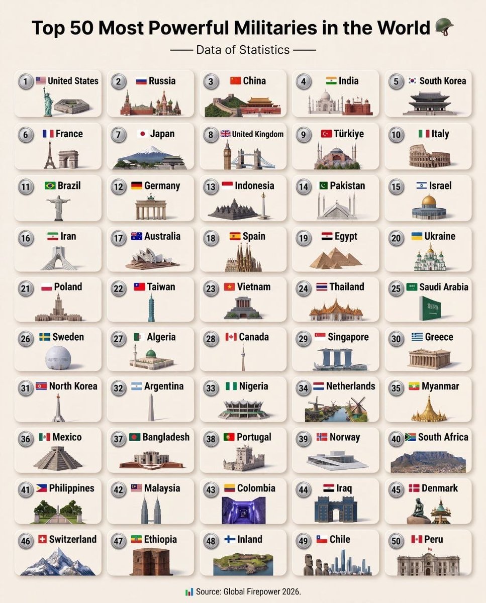 Top 50 Most Powerful Militaries 2026
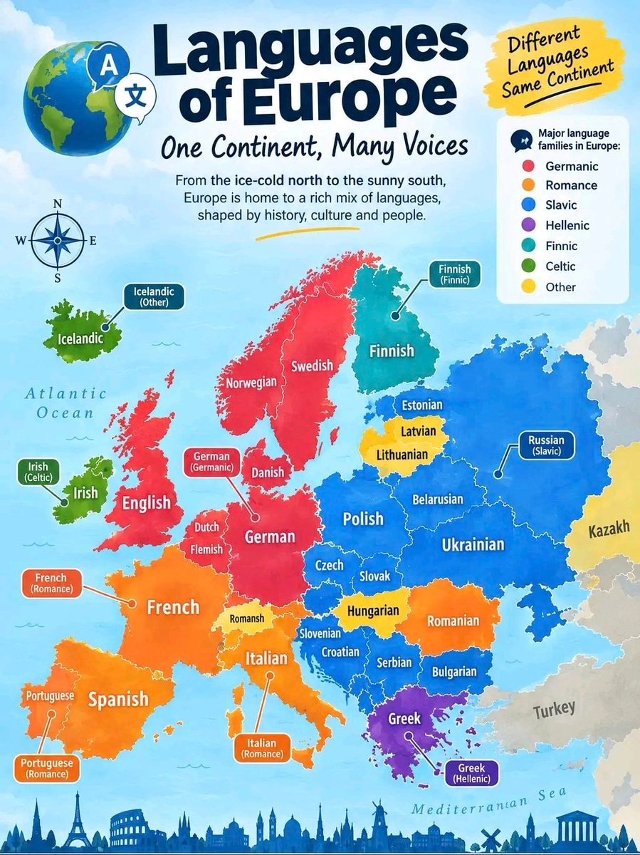 Languages of Europe infographic
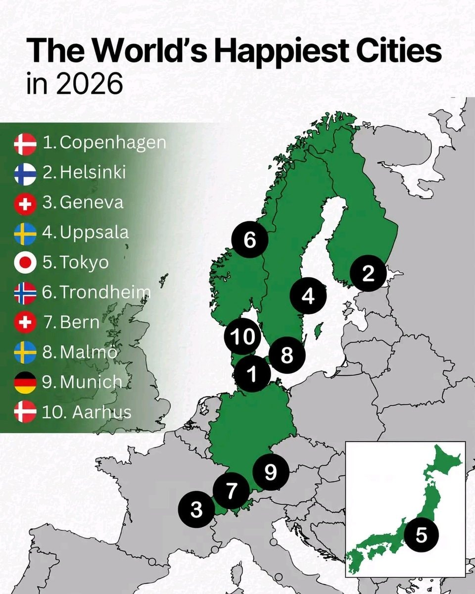 World's Happiest Cities in 2026
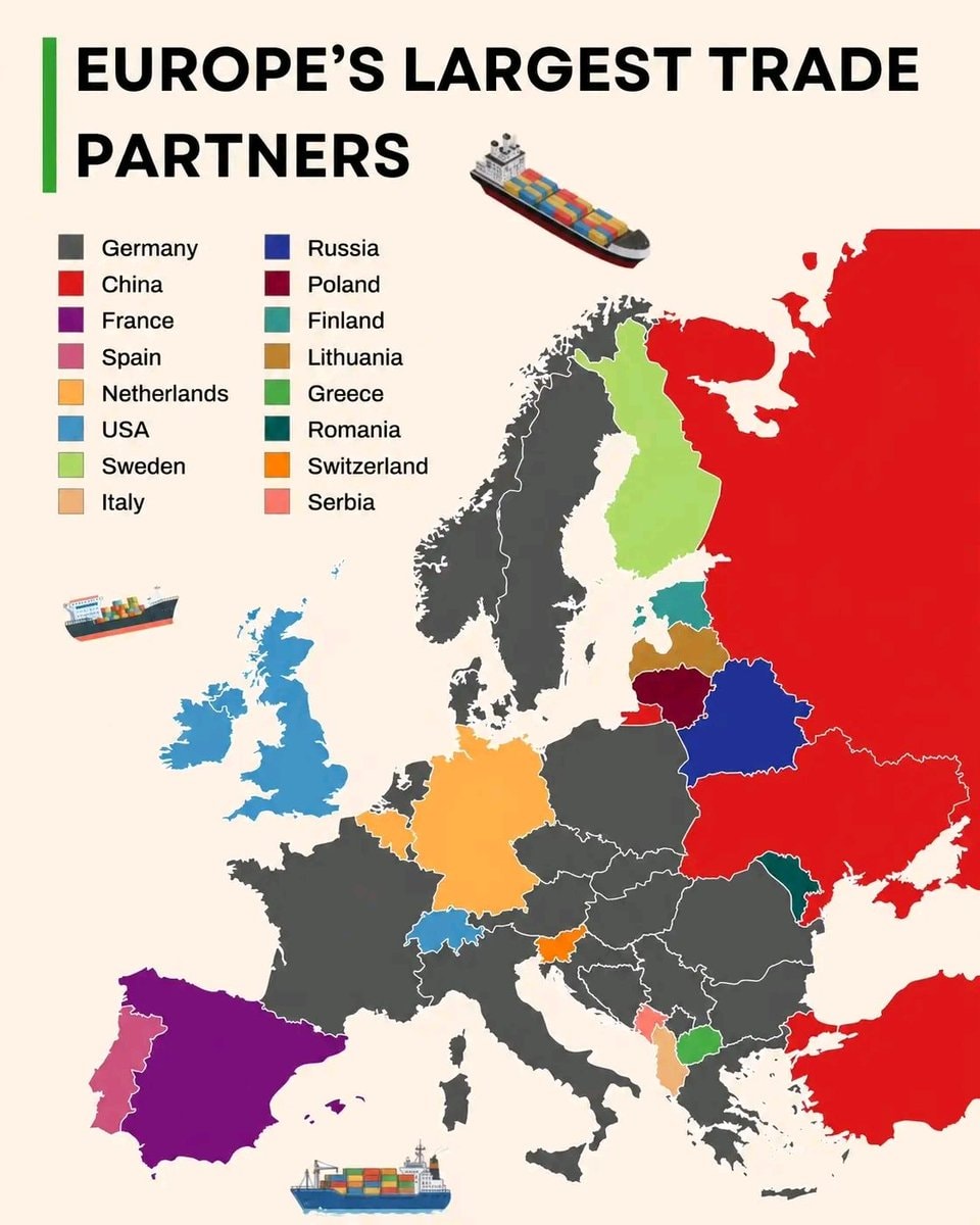 Europe's largest trade partners
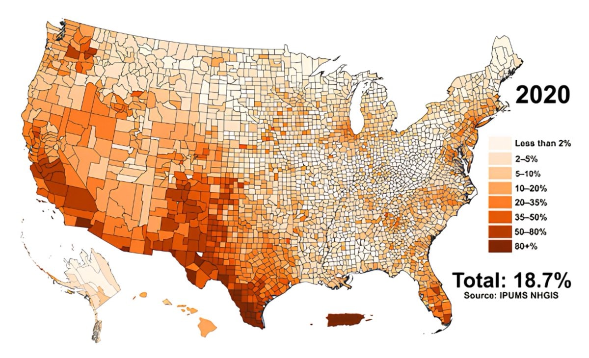 Hispanic population share by U.S. county
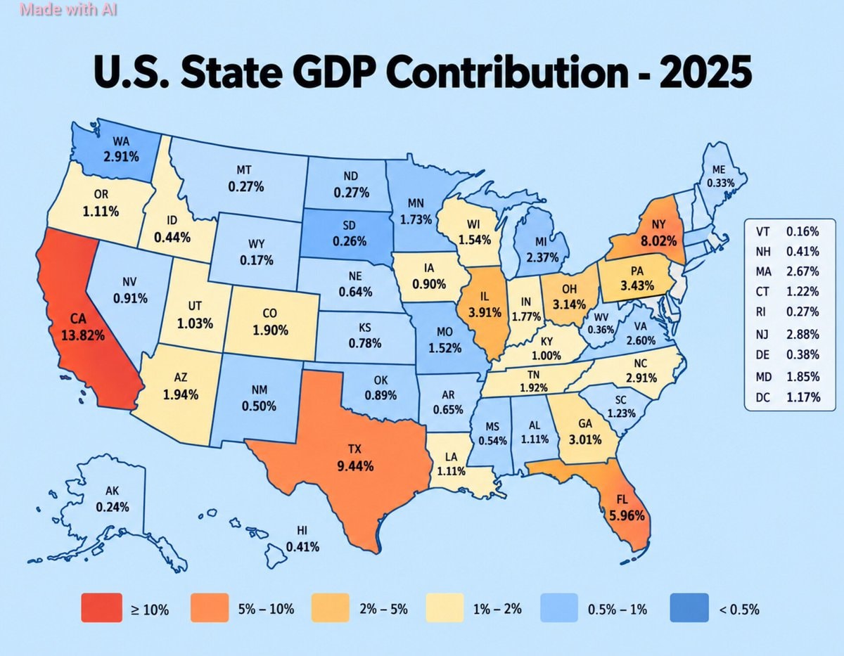 U.S. State GDP Contribution 2025
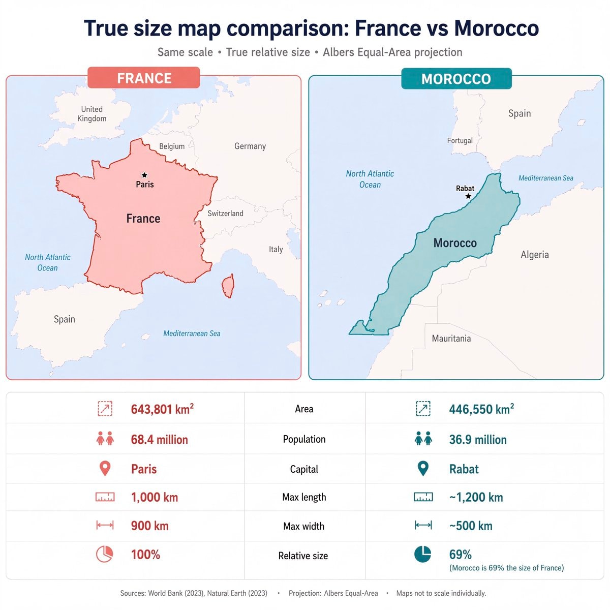 France vs Morocco true size map
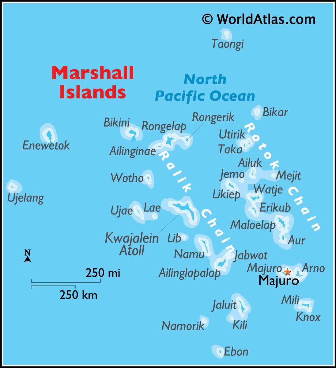 Marshall Islands map
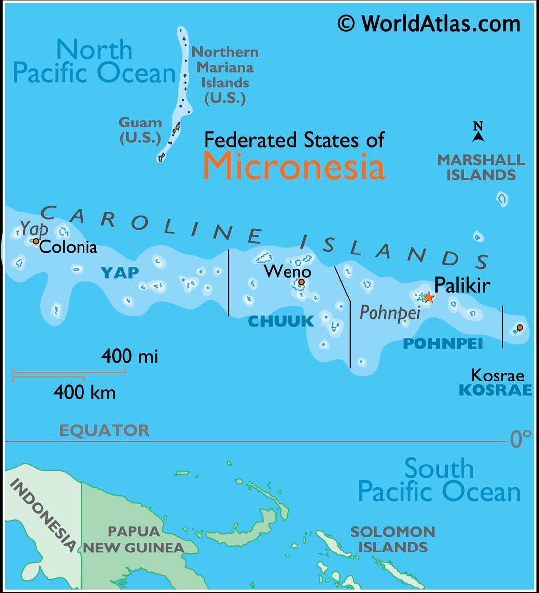 Micronesia map and facts
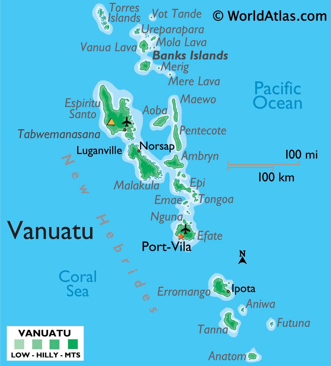 Vanuatu map and facts
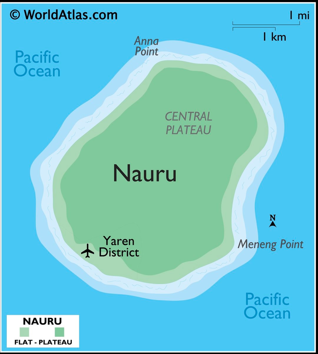 Nauru map and facts
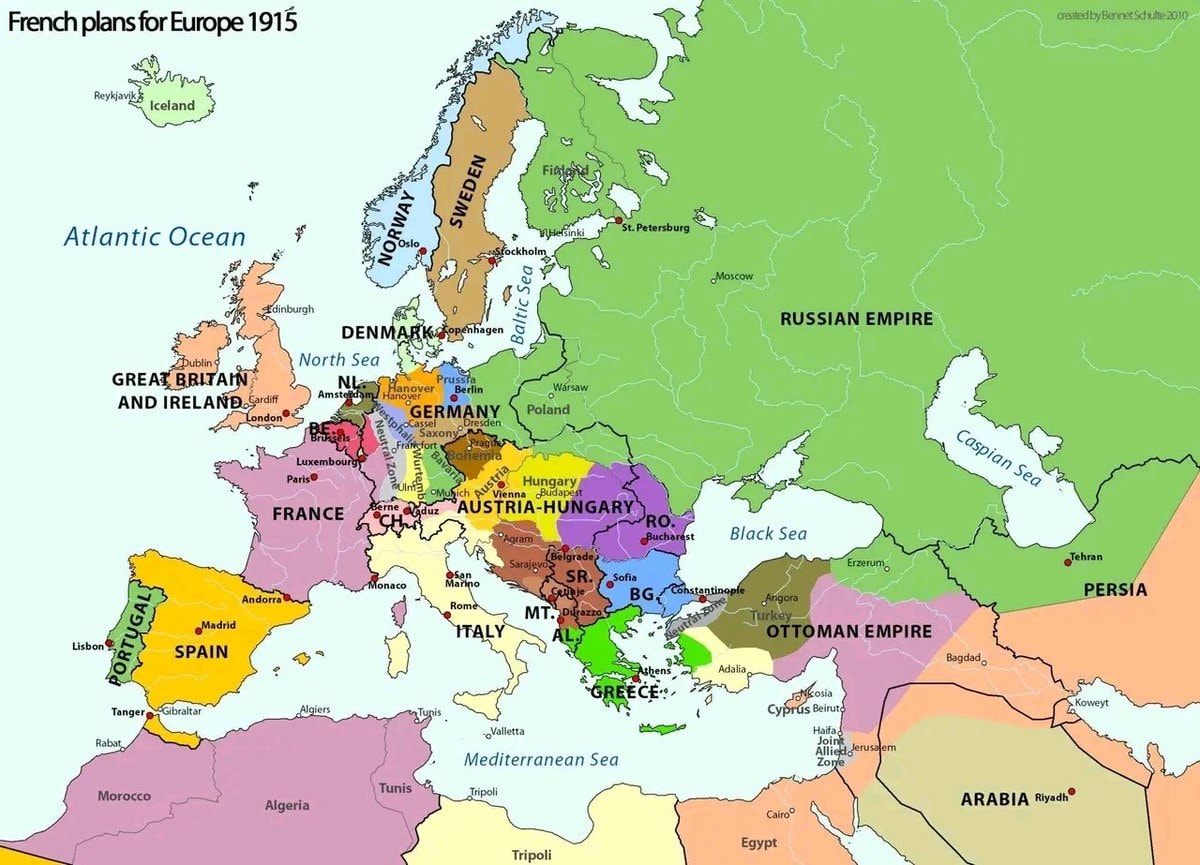 French plans for Europe 1915
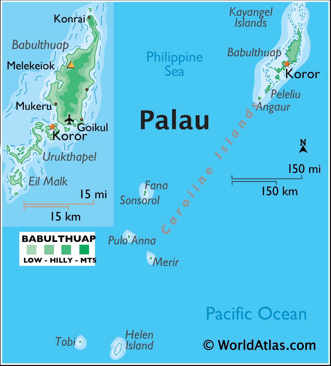 Palau map & facts
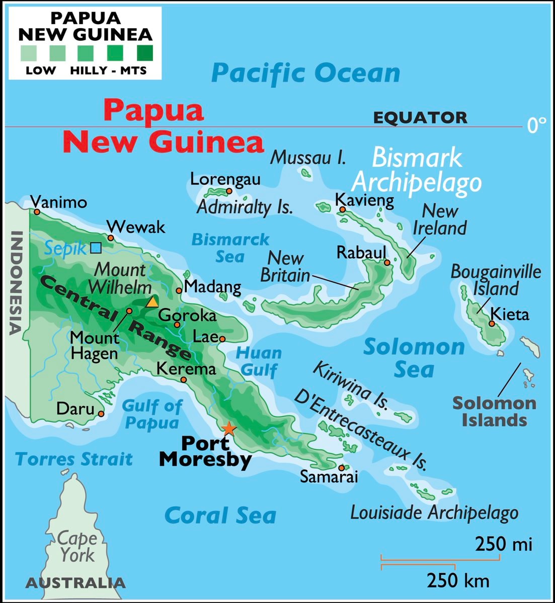 Papua New Guinea maps & facts
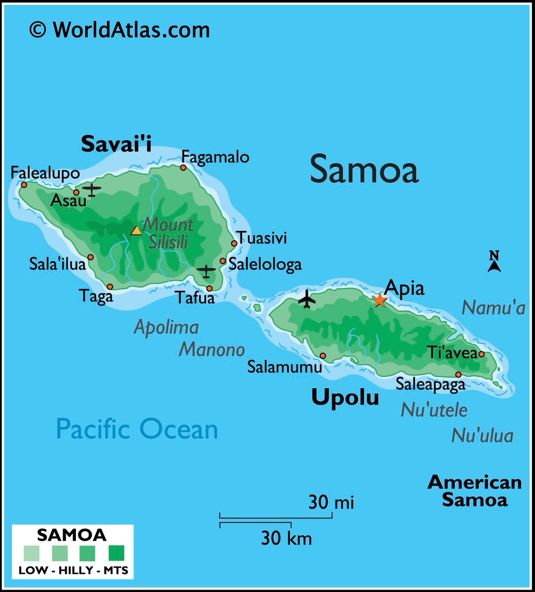 Samoa map and facts
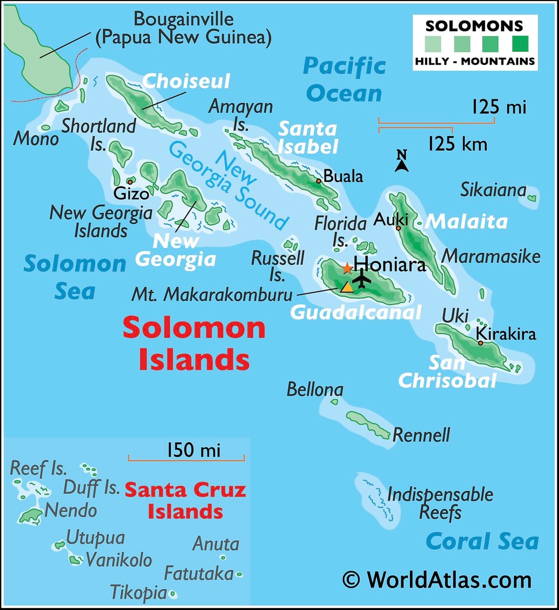 Solomon Islands map and facts
@scarlett_sItaly in 1796 🗺️ #InfoEditorials
查看原帖@scarlett_s 的照片· Sep 14, 2026· Info/Editorials
The image is a historical map of Italy. It shows various regions and kingdoms with their borders and names. The map is colorful and detailed, with a clear layout of geographical features and political divisions. The style is educational and informative, presenting a snapshot of Italy's political landscape at a specific historical period. Notable elements include the distinct colors used for each territory and the clear labeling of cities and bodies of water. ON-SCREEN TEXT: KINDGOM OF SARDINIA, FRANCE, SWITZERLAND, TYROL, CARINTHIA, AUSTRIAN EMPIRE, OTTOMAN EMPIRE, REP. OF VENICE, REP. OF GENOA, GRAND DUCHY OF TUSCANY, PAPAL STATES, KINGDOM OF SICILY, REP. OF RAGUSA, Corsica (France), Sardinia (Kingdom of Sardinia), Mediterranean Sea, Tyrrhenian Sea, Adriatic Sea, Ionian Sea.
还没有评论。来抢沙发吧!
Modern War Death Tolls8 ways to divide Mexico by stereotypeTop 50 Most Powerful Militaries 2026Languages of Europe infographicWorld's Happiest Cities in 2026Europe's largest trade partnersHispanic population share by U.S. countyU.S. State GDP Contribution 2025France vs Morocco true size mapMarshall Islands mapMicronesia map and factsVanuatu map and factsNauru map and factsFrench plans for Europe 1915Palau map & factsPapua New Guinea maps & factsSamoa map and factsSolomon Islands map and facts
还没有评论。来抢沙发吧!